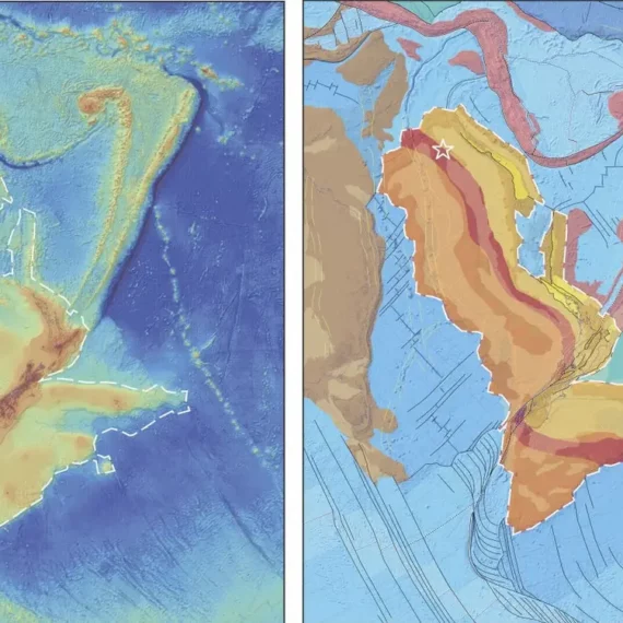
Zealandia broke apart from the supercontinent Gondwana millions of years ago then sank; It’s hard to study an underwater landmass, but researchers say they’ve created a complete map; Studying Zealandia’s geology helps scientists understand how and why supercontinents break up.
After decades of work, a team of scientists has finally completed a map of Zealandia. It’s helping them unlock the secrets of this lost continent’s mysterious past.
Zealandia is sometimes called Earth’s eighth continent. It stretches over 1.9 million square miles — about half the size of Australia.
But it was hidden, lost for millennia, because 95% of it is underwater. That makes it extremely difficult to map since most of its volcanoes, valleys, rifts, and mountains lie at the bottom of the ocean near New Zealand.
Resource: businessinsider.com
تماس با ما:
برای هرگونه پرسش یا درخواستی با ما تماس بگیرید.
تهران، بزرگراه محمدعلی جناح، فلکه دوم صادقیه به سمت میدان آزادی، ابتدای خ سازمان آب (ورودی پایانه اتوبوسرانی مترو)، انتهای خ نیرو، پلاک ۲، واحد ۳ (ZRK)، شرکت پژوهشی زمینریزکاوان، کدپستی: 1481654886


